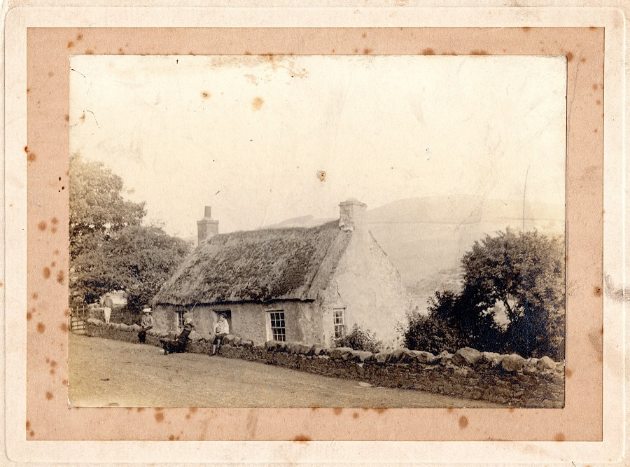
 The photograph shown above is one of several local images which Bill Rae collected and which are now stored in our archives in the old Mission Hall. Click on the image to see a larger version. As with some other photographs in our collection, however, both the donor and the identity of the subject are somewhat obscure. In this case someone has written in biro on the back of this fine photograph - 'House of Bob Nichol, joiner and market-gardener'. Unfortunately this is patently wrong. Several images of 'Nichols Cottage', aka 'Orchard Cottage' and, in the early nineteenth century 'Sweets Cottage', survive. One example is shown below, probably taken in the 1930s. As can be seen by the recently built bungalow in the background, Nichols Cottage was in Town Yetholm, a relatively 'urban' situation. It was, for many generations, the house of the family which owned the market garden in Town Yetholm but which is now, sadly, a ruin; the market garden is now Yetholm Yew Tree Allotments. Comparison of the two photographs makes it clear that, although they are both very similar, the kind of cottage that was once the basic housing unit in this area in the 18th and 19th-centuries, they are not of the same building. Where, then, is the mystery cottage located? 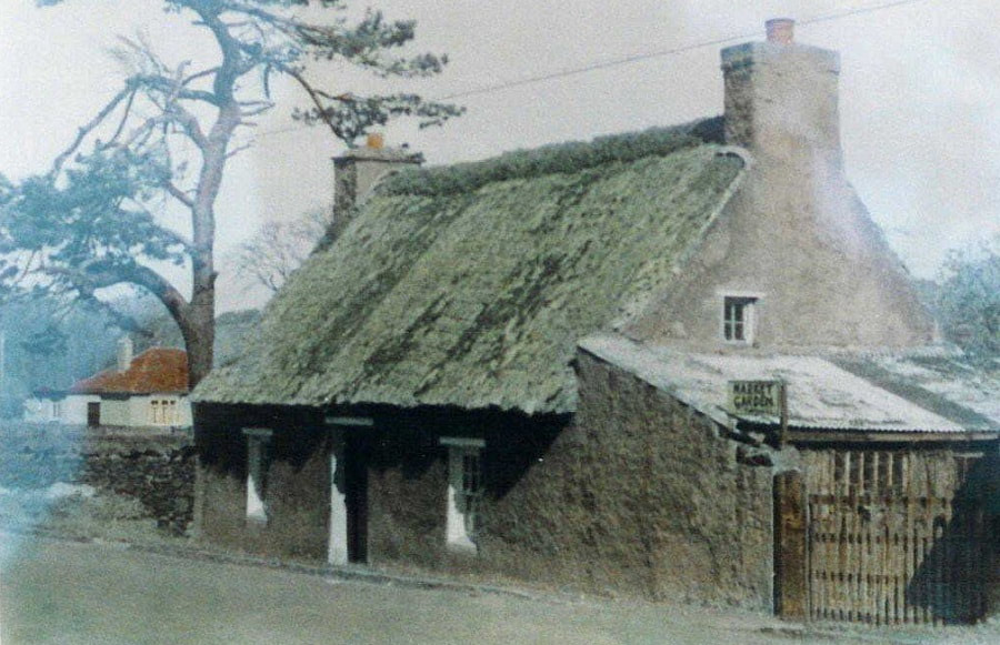 One suggestion is that it shows the cottage currently known as 'Catch-a-Penny', which is found well out of both Town- and Kirk-Yetholm, on the road from Kelso, where a lane branches off to Cherrytrees. A recent image of 'Catch-a-Penny', lifted from Google Streetview, can be seen below. The thatch has long since gone, but the slope of the road and the profile of the hill in the background is somewhat similar. 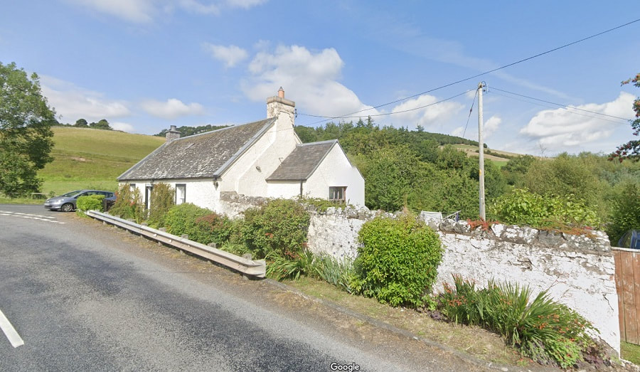 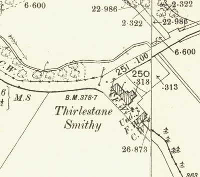 As with 'Nichols Cottage', 'Catch-a-Penny' is one of several names by which this house was known. It is taken by many local people to indicate that it was at some point a toll-house, but this is not the case. In all nineteenth century maps it is referred to as 'Thirlestane Smithy' and in the 1851 and 1861 censuses it is called 'Clock Mill Smithy' ('Clock' probably being a mistranscription of 'Cleugh'). In 1851 blacksmith John Bennet, his wife, his two children, three apprentices and one female house servant are said to be living there. How could they all have fitted in? There is also no sign of a smithy in the photograph - perhaps the workshop was located at the rear, in what appears to be an extension, as shown on the OS 25 inch map of 1892-1905 (which must be about when the photograph was taken)? Or perhaps it was in the detatched building to the side? A larger problem is that the OS map appears to show two cottages side-by-side - this would help explain how the large number of people listed in the 1851 census could have resided there - but such a double building corresponds neither with the mysterious photograph, or with the site as it exists today. Alternatively ... After we originally posted this blog, Ned Pegler has written to us and suggested that the profile of the hill in the background of the photograph corresponds with that of Venchen hill as seen from the road by Yetholm Hall. This certainly does seem to be the case - see the collage Then/Now image below: 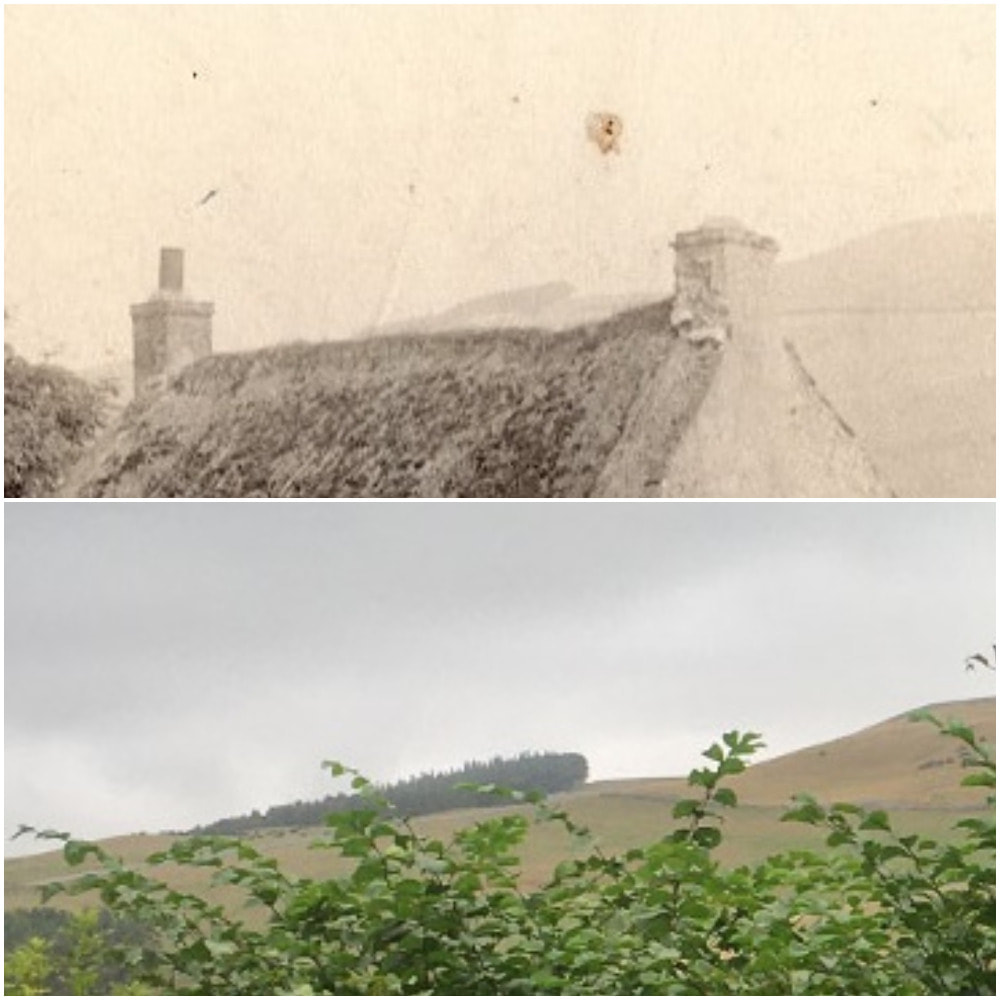 It is interesting that wood which can be seen in the modern image was also present in the old photograph. There is no cottage there now, simply a rather overgrown hedge, but there was a cottage there once as can be seen in the maps below. The upper map shows the first Ordnace Survey map of the village (surveyed in 1859), while the lower image is from the 6-inch Ordnance Survey map of 1888-1913. The cottage is marked by an arrow. This long-gone cottage seems a better candidate than 'Catch-a-Penny'. The photograph may have been taken around the turn of the century, but why? Presumably it was demolished soon afterwards. It is good that we have managed to preserve this record of a now-forgotten bit of old-Yetholm. Thanks to Ned for making this identification. 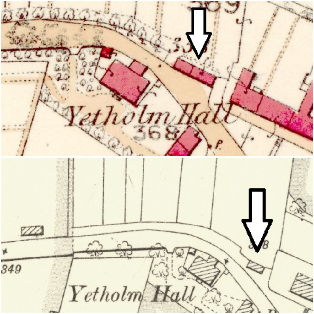 Rummaging through the YHS photo archive a postcard image has been discovered, in which the roof of this cottage can be glimpsed in the bottom-right corner - the red arrow highlights the spot in the enlarged lower portion. We have a version of this card posted in 1909, but we also have a different card, taken from the same spot, postmarked 1910 - so the cottage must have been demolished before that date. A view taken from the same spot from a post card sent in 1910 is shown below. 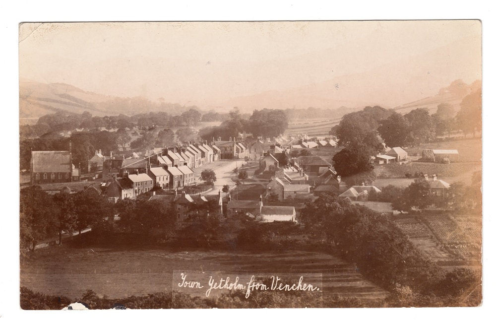
41 Comments
|
Archives
July 2024
|
 RSS Feed
