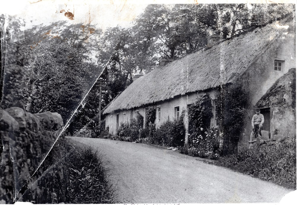
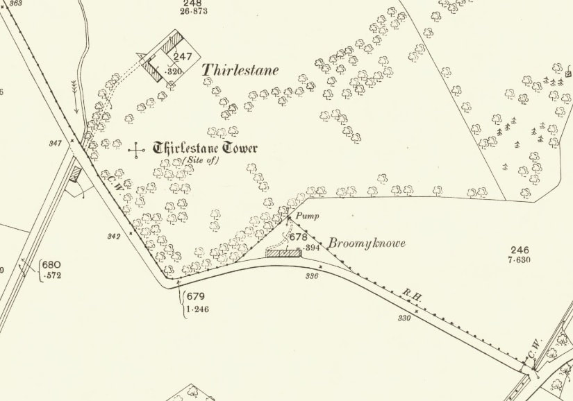
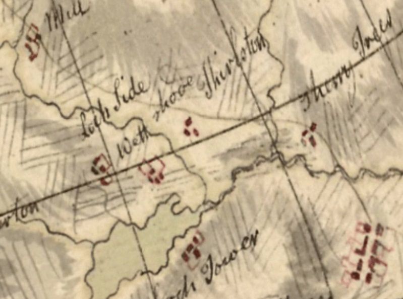
 The photograph above shows the lovely cottages called Broomieknowe, which once stood on the Yetholm to Kelso road, close to Thirlestane. Unfortunately all three cottages were destroyed by a fire in 1933, apparently as a consequence of a spark from a passing traction-engine - see the report below from the Berwick Advertiser of the 30th March 1933: 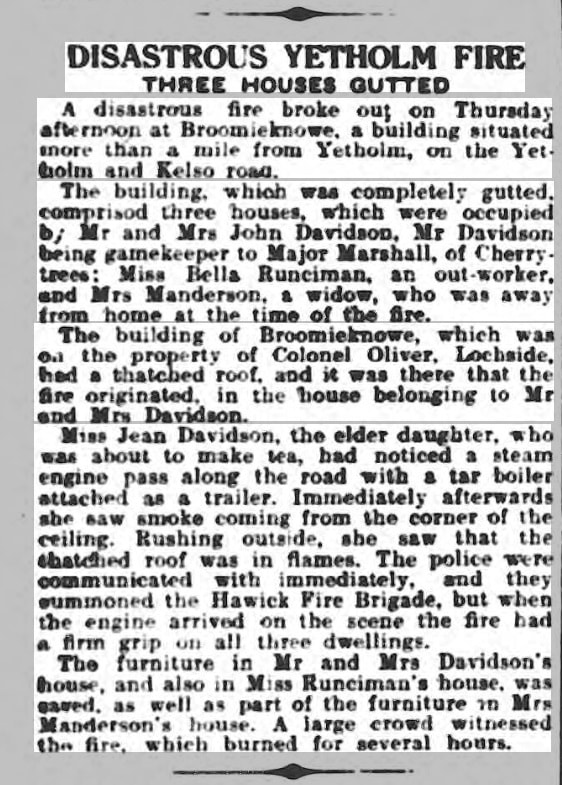 The position of these cottages can be seen on the map below (left). The ground in that area is low-lying and rather boggy. The Roy Military Map from the mid-eighteenth century shows a settlement called 'Wett Shode' between Thirlestane and Lochtower (below, right). The positioning of settlements on the Roy map is rather imprecise, so it is difficult to be confident about the location of this mysterious place. However, the name 'Wett Shode' (eg 'Wet Shod') sounds like one of those jokey names, like 'Seefew' down the Bowmont valley, presumably indicating that it's inhabitants frequently experienced wet feet. It may well have been an earlier version of the more recent 'Broomieknowe', with its more picturesque name. Nothing at all can be seen of the cottages today.
1 Comment
Edward Pegler
28/10/2022 09:06:11 am
By the way, 'wet shod' appears, as you say, to be a joke version of the sites more formal name, West Ho(l)d, which is on the Stobie Map of 1770. Sadly, the location of West Hod is definitely to the west of Primside/Yetholm Loch and south of Thirlestane Burn, perhaps somewhee near the junction of the present Yetholm and Cherrytrees roads (near Catchapenny), so won't be Broomieknowe. Leave a Reply. |
Archives
April 2024
|
 RSS Feed
