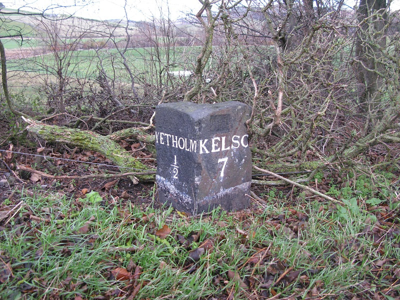
 Folks from Yetholm can hardly have failed to notice the recent resurrection of a number of old milestones along the road to Kelso. Their restoration is due to the hard work of Derek Robeson and Graeme Walker who carefully searched for, dug up, repainted and stood them upright once again. Many thanks to them for their hard work. It's a pleasure to catch sight of these neatly carved stones marking off the miles as we travel to and from our local metropolis. When were they made? Who put them up in the first place? The stone shown above is the one closest to Yetholm, not far from where the famous Yetholm Bronze-age shields were discovered. Each of the Yetholm-Kelso stones is marked on the first Ordnance Survey map of the area, which was surveyed in 1858 - click on the map below for an expanded version of this image, which shows the site of this particular stone - so they were there by that date. 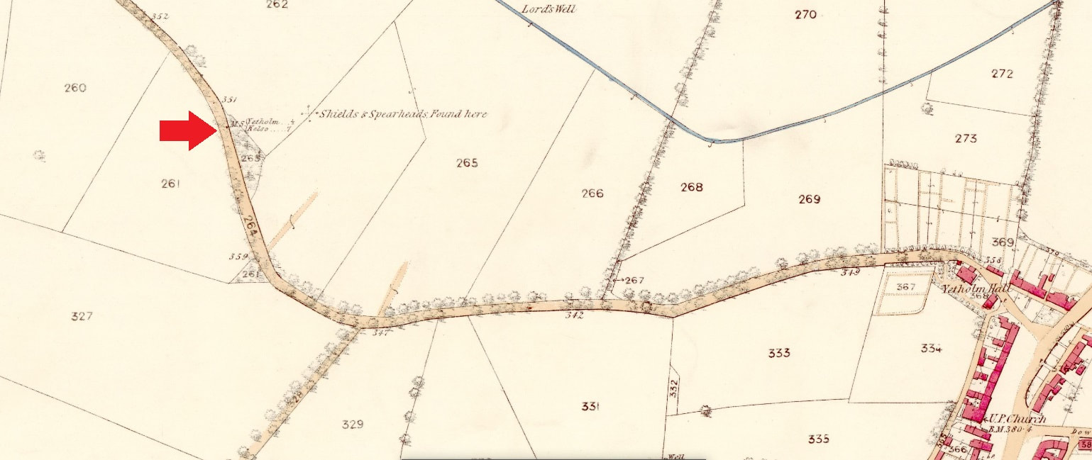 But who payed for, made & then installed them? It is generally agreed that throughout the eighteenth century the main road (or track!) from Yetholm went on the other side of the valley from the existing road, via Cherrytrees. The top map in the image below (published 1822) shows this arrangement, but what is now the main road, travelling via Lochtower /Thirlestane, appears to have been in existence by 1840, as both roads are shown on the lower map, published by Johnston's of Edinburgh in that year. 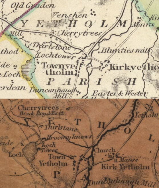 It seems most likely that the stones were erected by the trustees of the Kelso to Wooler turnpike. However the problem with this theory is that the turnpike road ran along the Cherrytrees road, making its way to the tollhouse at Venchen and avoiding entering Town Yetholm. That, at any rate, is what John James Mackay says in his book Border Highways, which is the most authorative text on the subject: Just over a mile before Town Yetholm, the turnpike left the main track and took a parallel one past Cherrytrees, so did not actually enter the village at all ... At no time then did Town Yetholm ever have a turnpike road running through it and today's road into the village was no more than a track until late in the last century. (p.138) This can't be right on a number of points - firstly the older Cherrytrees road is actually the 'main track', as all early maps witness, and secondly, as we have seen, the branch of the road that runs into the village is clearly shown on a map dating from 1840, far earlier than Mackay suggests. However, the point about no turnpike running through the village does seem to be accurate. If this is the case, though, why would the turnpike trustees have erected a milestone on a stretch of the road which was not their responsibility? For the stone shown in the photograph clearly is part of the same series, the rest of which are carefully placed all the way along the official turnpike road into Kelso. Perhaps they were just feeling in a generous mood? Sadly, at around the same time as Derek and Graeme were recovering the lost milestones, Storm Arwen (26th/27th November) hit the area bringing down several of the beautiful old oaks which ran along the Back Ditches, once the other toll road in the Yetholm area, from Jedburgh to Wooler, which similarly avoided going through Town Yetholm. Instead it crossed the Bowmont below the 'picnic area' and went straight into Kirk Yetholm. This toll road was probably made around 1820 and, given their size, the trees were probably planted not long after. Thankfully most of the avenue of oaks are still standing, but it is sad that that some of these fine specimens have been brought down. The image shown below shows some of the devastation a few days after the storm. 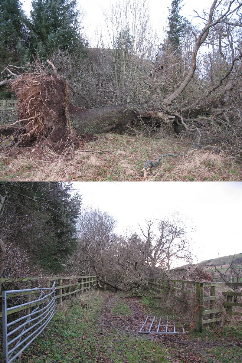
1 Comment
|
Archives
May 2024
|
 RSS Feed
